


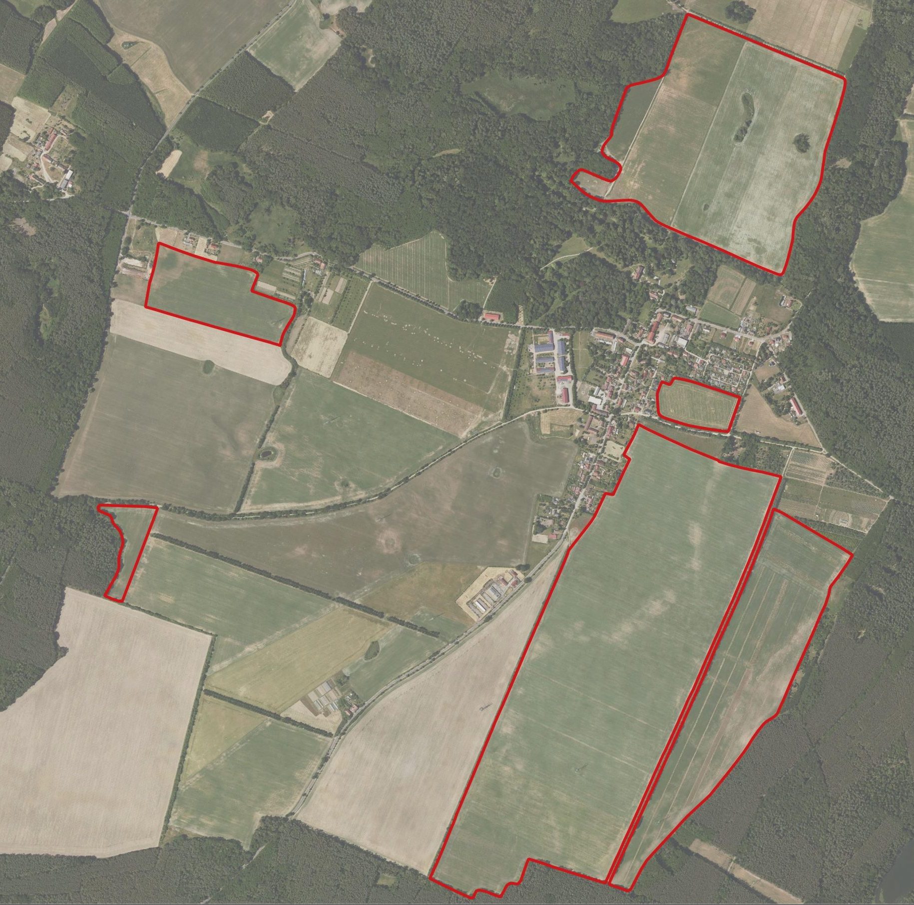
Click on the indivudal fields to find out more on their agricultural management.
Reference field
Our reference field is organically farmed in the classical sense in order to better understand and record the influence of the different forms of landuse, both scientifically and economically.
Agroforestry
Planting strips of trees and shrubs on agricultural land leads to the creation of agroecosystems that that are based on the natural occurence of trees and shrubs in the landscape. The agroforestry systems follow the principles of syntropic agriculture and are integrated into arable farming practices.
Multifunctional regenerative eco-farming
On the arable land studied, organic farming methods are implemented in combination with additional measures that promote humus formation. These include the cultivation of cover crops and undersown crops, flower strips, no-till farming and cattle grazing.
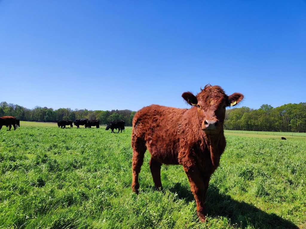
Holistically managed suckler cow husbandry
More than 150 cattle are integrated into the crop rotation through holistic grazing management and as an integral part of the ecosystem. This is characterized by the fact that the cattle are kept outside all year round and eat, wherever possible, grasses and legumes that grow all year round. Depending on the season, the cattle is moved onto plots with fresh growth up to 5 times a day.
Multifunctional regenerative eco-farming
On the arable land studied, organic farming methods are implemented in combination with additional measures that promote humus formation. These include the cultivation of cover crops and undersown crops, flower strips, no-till farming and cattle grazing.
You can find out more about the farming methods here:

On the test sites, the effects of different management practices on soil, water, biodiversity, (micro)climate, and animal welfare are measured in field trials, while identifying practical measurement methods and indicators.
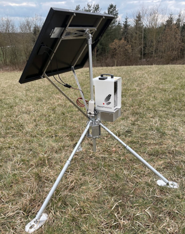
Weather

For a scientific evaluation of all measurements, the prevailing weather conditions must be documented. Weather stations permantly recording parameters such as temperatures, precipitation, solar radiation and wind are used for this purpose. Several stations are installed on the test fields in order to thoroughly investigate the climatic effects across all testing areas and to be able to accurately map the sometimes significant micro-variability in the terrain climate.
![]()
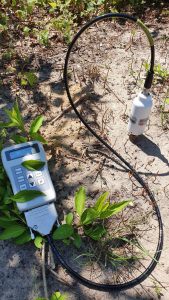
Soil texture
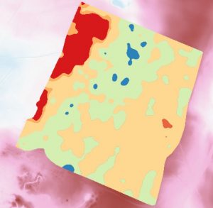
The soil texture provides information about the storage capacity for nutrients and water. This is measured in the field using the Geophilus multi-sensor system, which consists of a gamma sensor and a rolling electrode system for recording apparent electrical resistance at five different depths up to 1.5m. in conjunction with a few reference laboratory analyses, high-resolution soil texture maps are generated from this data.
![]()
Soil moisture
Soil moisture has a major influence on plant vitality and therefore on potential yields. This is measured using soil moisture probes or modeled using digital relief analysis (topographic moisture index), sensor-based soil texture maps and data from handheld reflectance spectrometers calibrated using laboratory reference analyses.
![]()
Humus content

Site-optimized humus management is a central component of nutrient- and resource-efficient agriculture, securing soil fertility in the long term and minimizing environmentally harmful and climate-damaging substance emissions. The humus content is modeled using drone and satellite images or handheld reflectance spectrometers. In order to create the required calibration models, the humus content of reference samples is measured in the laboratory.
![]()
Erosion risk potential
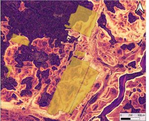
Using freely available high-resolution digital terrain models, the movement of water on the earth's surface can be modeled and the relief-related susceptibility to erosion can be estimated. Together with a mapping of erosion forms in the terrain, the erosion risk potential can be depicted. This provides a basis for targeted management measures to minimize erosion, reduce material discharges and thus protect water bodies.
![]()
Soil microorganisms
Communities of soil microorganisms are recorded using molecular biological methods. After extracting microbial DNA from soil samples, the amount of bacteria and fungi in the extractions is determined using real-time PCR (real-time polymerase chain reaction).
![]()
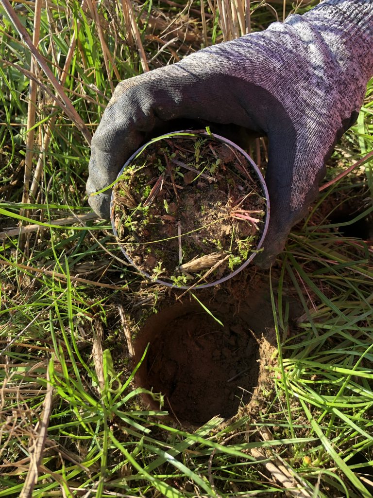
Earthworms
Earthworm communities are extracted from the soil by chemical extraction in the field. Earthworms that cannot be identified morphologically are determined by means of high-resolution melting curve analyses using real-time PCR.
![]()
Flying insects
With the help of three infrared sensors, various forms of cultivation will be examined in terms of flying insect biodiversity over the course of the project. These record the activity of the entire flying insect fauna in real-time and can differentiate between individual insect species. Through methods of machine learning the sensors are trained to identify different species based on wing beat frequency, body size and other unique characteristics.
![]()
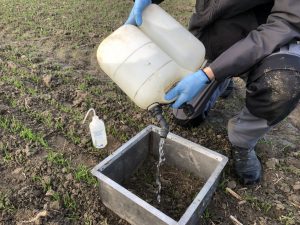
Soil greenhouse gases

The soil greenhouse gas fluxes of carbon dioxide (CO2), methane (CH4) and nitrous oxide (N2O) are measured in the field using a Fourier transform infrared spectrometer (FTIR). The FTIR sensor enables precise and parallel measurement of CO2, CH4 and N2O in real-time.
![]()
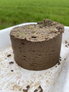
Soil organic carbon
The content of organic soil carbon is determined by means of combustion and subsequent thermal conductivity detection. In addition to the percentage of organic carbon in the soil, the amount of organic carbon per unit area (carbon stock) is to be calculated by determining the soil density.
![]()
Health monitoring
Our aim in the DaVaSus project is to assess the welfare and health of cattle in a year-round grazing system. To this end, modern sensors and monitoring systems are used to analyze physiological and ethological parameters in individual animals in conjunction with management practices and environmental conditions. The animals are also not being affected by the continuous measurements.
![]()
Pasture biomass estimation
 For scientific validation within the automated animal monitoring, it is necessary to assess the productivity and quality of the vegetation. alongside animal monitoring, this involves dry matter measurement and biomass estimation using multispectral imagery supplemented by an analysis of nutrients. Additionally, it is essential to consider the influence of the surrounding climate to gain an optimal understanding of animal behavior and pasture management.
![]()
![]()

In addition to the classical economic evaluation, the project places significant emphasis on the valuation of ecosystem services to provide farmers with comprehensive results regarding their management practices, as digitally and automatically as possible and represented in a dashboard.
Economic indicators
With the help of digital tools, agricultural management measures, working hours as well as relevant financial accounting parameters are recorded and transferred to the database. This creates a basis for the economic evaluation.
Total operating cost calculation
On the basis of planning data and data from the test and reference areas, the KTBL calculates the total operating costs of the farm. The aim of the total operating cost calculation is to map and compare farms economically.
Cost-benefit analysis
In contrast to the total operating cost calculation, the cost-benefit analysis does not consider the entire company, but only individual production processes. For selected production processes, indicators such as the output free of direct and labor costs or the output free of individual costs are determined.
Determination of working time
For working methods for which the KTBL has little or no planning data, the labor and time required is recorded to enable reliable determination of the operational cost of the future farm. This will particularly concern suckler cow husbandry and agroforestry systems.
![]()
Regionalwert Leistungen GmbH uses their value-performance calculation to evaluate and monetize the sustainability performance of farms based on around 300 key indicators. This can be, for example, the effort required to implement a crop rotation involving many different squences, which has a positive effect on soil health but is not explicitly rewarded by the market.
The sustainable AG also conducts a monetary valuation of ecosystem services based on the True Cost Accounting (TCA) approach. In this process, meaningful parameters are related to their monetary value, enabling the assessment of the impact of individual parameters (e.g., soil organic matter content, nitrous oxide emissions, etc.).
In the project, the sustainability performance of the experimental operation is to be captured and monetized using both approaches and compared with the ecological measurements of the project partners.
![]()
![]()